
The UGIC Board is made up of elected volunteers who serve a 3 year term representing city, county, state, federal, higher education, industry, and ‘at large’ user groups.
Board Members

Chair
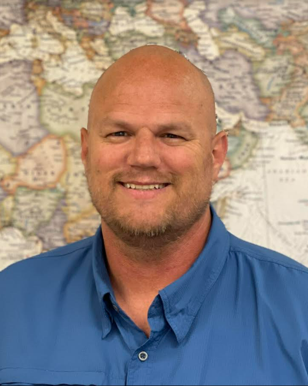
Chris
McGinty

Vice Chair
Sarah
Lindsey

Secretary
Sarah
Lawless

Treasurer
Julia
Surkis

Lindsy
Hales Bentley
Director

Shawn
Beecher
Director

Stan
McShinsky
Director

Christina
McCullock
Director

Mellissa
Campbell
Director

Phoebe
McNeally
Associate Director

Jordan
Merrell
Associate Director

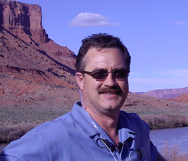
Tim
Triplett
Associate Director

Hank
Chou
Associate Director

Dave
Henrie
Emeritus

Kasey
Hansen
Emeritus
Directors
Higher Education

Chris McGinty
Company: USU Remote Sensing/GIS Laboratory
Location: 5275 Old Main Hill, Utah State University, Logan, UT, 84322
Phone: (435) 797-0653
UGIC Position: Chair
Primary Sector: Higher Education
UGIC Board Member Thru: 2027
Bio: Chris McGinty is the associate director of the Remote Sensing/GIS Laboratory at Utah State University. He has spent more than 15 years using geospatial technology in both private and academic settings. As a student when command line was still the best way to conduct geospatial analysis, Chris had the opportunity to observe and take part in the paradigm shift in the way we teach and use geospatial tools. Throughout Chris’ time at Utah State University, he has had the opportunity to engage hundreds of students in Introduction to Geographic Information Science as well as Advanced Geographic Information Systems courses he has taught. As many know, teaching these rapidly evolving courses can be very challenging, but above the challenge, extremely rewarding. Chris will bring a great level of enthusiasm and excitement to the position and would look forward to supporting UGIC in its efforts to further and promote the teaching and use of geospatial technologies as well as enhancing the connection and participation of Utah’s K-12 schools and high education institutions.
At-Large

Lindsy Hales Bentley
Company: Central Utah Water Conservancy District
Location: 1426 E 750 N Orem, Utah 84097
Phone: (801) 226-7100
UGIC Position: Director
Primary Sector: County
UGIC Board Member Thru: 2027
Bio: Lindsy Hales Bentley has been doing GIS for over 20 years. She graduated from Utah State University in Geography and Parks and Recreation, and has her GISP. She currently works for the Central Utah Water Conservancy District, the largest water district in the state (covering 7 counties). She works in the Asset Management group to produce detailed mapping of district’s $3.5 billion dollars of infrastructure. The most fulfilling work of her career has been her continued participation in the Unified Police Department and Attorney General’s Child Abduction Response Teams for the past 13+ years. Lindsy loves giving back to the GIS community and passing on her knowledge. She has also served on the UVGIS and SLUG Boards over the years.
Lindsy’s favorite thing in the entire world is adventuring with her daughter. She also loves the HOT sun, food is her love language, hot sauce, music, and all things outdoors, including camping, hiking, paddle boarding and playing with her dogs.
City
Shawn Beecher
Company: Spanish Fork
Location: 40 S Main St Spanish Fork, UT 84660,
Phone: 801-804-4571
UGIC Position: Director
Primary Sector: City
UGIC Board Member Thru: 2027
Bio: Shawn is the GIS Administrator for Spanish Fork City taking the GIS there from humble beginnings to a massive program everyone uses. Done through building an enterprise GIS and databases, incorporating field collection, dashboards, online maps/apps, asset management (using GIS), starting utility networks, ArcGIS QuickCapture and incorporating as many ESRI GIS tools as he could.
He graduated from BYU with a B.S. in GIS and Cartography in 1998. He’s had various GIS experiences, including working as a mapping intern at BYU, an intern for the City of Springfield, MO, a GIS Specialist for an Engineering Firm in Kansas City, MO, and a GIS Specialist II in Logan, UT until he landed in Spanish Fork in 2003. He received his GISP in 2011, has presented at UVGIS, UGIC, ESRI SWUC, and ESRI UC, and published an article in the Fall 2018 ArcNews. He has served on the UVGIS and UGIC Boards, and is a proud member of UMETT.
He is a strong advocate of GIS, and his motto at work is “If you build it, they will come.” He loves seeing the excitement in others as GIS improves their lives through the tools we build. He is excited to serve the members of UGIC. When he is not at work, he enjoys spending time with family, canoeing, fishing, swimming, camping, boating, being on a beach, exploring Utah’s wonders, and just being outside.
At-Large
Stan McShinsky
Company: Provo City
Location: 445 W Center St, Provo, UT, 84601
Phone: (801) 852-6561
UGIC Position: Director
Primary Sector: City
UGIC Board Member Thru: 2028
Bio: Stan McShinsky is a skilled GIS Web Developer at Provo City, where he combines his passion for mapping with his knack for web development. With a creative flair, Stan enjoys constructing intriguing maps that resemble puzzles, augmented reality sandboxes, mazes, and captivating map art. Currently, he focuses on developing web applications for diverse projects within the city.
In addition to his GIS expertise, Stan holds a certification as a drone pilot, showcasing his commitment to exploring innovative technologies in the field. Beyond his professional pursuits, Stan finds joy in playing pickleball and even serves as a certified referee in the sport. Having graduated from BYU, he brings a strong educational foundation to his work. Stan’s multifaceted interests and dedication to his craft make him an exceptional GIS professional with a zest for exploration both on and off the map.
County

Mellissa Campbell
Company: Carbon County
Location: 751 E 100 N, Price, UT 84501
Phone: (435) 636-3775
UGIC Position: Director
Primary Sector: County
UGIC Board Member Thru: 2028
Bio: Mellissa Campbell is the GIS Administrator for Carbon County, Utah, where she manages countywide geospatial programs and supports local government operations through data-driven mapping and analysis. With over 17 years of experience in GIS, she specializes in system administration, web GIS development, mobile data collection, and stakeholder collaboration.
Mellissa previously served on the UGIC Board for 10 years, holding leadership positions such as Treasurer, Conference Chair, and Board Chair. Her continued involvement with UGIC reflects her commitment to advancing GIS education, innovation, and collaboration across Utah’s geospatial community.
In her spare time, Mellissa enjoys watching her daughters cheer and shoot archery, as well as traveling and exploring new places.
At-Large

Julia Surkis
Company: Utah Division of Emergency Management
Location: 4315 S 2700 W Ste 2200, Taylorsville, UT 84129
Phone: (801) 538-3400
UGIC Position: Director/Treasurer
Primary Sector: State
UGIC Board Member Thru: 2028
Bio: Julia is the GIS Program Manager for the State of Utah’s Division of Emergency Management, where she leads projects that support spatial decision making before, during and after disasters. She also provides GIS consulting services for FFKR, an Architecture and Urban Planning firm based in Salt Lake. Julia has over 5 years of professional experience in GIS and holds a Master’s in GIS from the U. Currently, she is the chair of the Utah Mapping Emergency Technical Team, a group that meets quarterly to share best practices in Emergency Management GIS. As program manager, she is involved with a variety of projects in her day-to-day, but primarily focus on Web GIS and making spatial data accessible and actionable for non-technical stakeholders.
When Julia is not mapping, she enjoys mountain biking, climbing peaks with her husband, cooking, reading, playing strategic board games, or getting in way over her head in home renovation projects.
State
Sarah Lindsey
Company: Department of Natural Resources in the Division of Wildlife Resources.
Location: 1594 W North Temple, Salt Lake City, UT 84116
Phone: (801) 538-4759
UGIC Position: Vice Chair
Primary Sector: State
UGIC Board Member Thru: 2029
Bio: Sarah Lindsey is a Utah native who loves using maps to explore the diversity and natural beauty of our state. She graduated from the University of Utah with a B.S. in Geography and a certificate in GIS. Sarah works for the Utah Division of Wildlife Resources (UDWR) as a Senior GIS Analyst and as the Data Manager for the Utah Natural Heritage Program. Her work focuses on using geospatial technology to track the distribution of species of greatest conservation need, ensuring this crucial information reaches decision makers in order to protect threatened and endangered species, inform conservation actions, and sustain Utah’s wildlife biodiversity for years to come. Sarah also collaborates with UDWR’s Law Enforcement section using GIS applications to streamline investigation workflows and improve reporting processes for the public.
Industry
Christina McCullock
Company: Gateway Mapping, INC,
UGIC Position: Director
Primary Sector: Industry
UGIC Board Member Thru: 2029
Bio:
At-Large
Sarah Lawless
Company: Wasatch Front Regional Council WFRC
Location: 41 N Rio Grande St, Salt Lake City, UT 84101
Phone: 801-380-4115
UGIC Position: Director/Secretary
Representing: At-Large
Primary Sector: County
UGIC Board Member Thru: 2029
Bio: Sarah is the GIS Lead and a Senior Data Scientist at Wasatch Front Regional Council, where she develops GIS applications and data-driven tools to support regional planning and decision-making. She earned a bachelor’s degree in GIS from Brigham Young University and a master’s degree in Business Analytics from Southern Utah University. Over the past eight years, she has worked in both consulting and regional government on a wide variety of GIS projects. She especially enjoys building web applications and using maps and data visualization to make complex information more accessible and meaningful. She is excited to serve on the UGIC Board and support Utah’s GIS community through collaboration, education, and the continued advancement of geospatial technology.
Associate Directors
Phoebe McNeally
Company: University of Utah
Location: DIGIT Lab, 675 Arapeen Dr Rm 121, SLC, UT 84132
Phone: (801) 585-9133
UGIC Position: Associate Director
Representing: Higher Education
Primary Sector: Higher Education
UGIC Board Member Thru: Appointed
Bio: Phoebe McNeally is a Research Associate Professor of Geography at the University of Utah and the Director of the DIGIT (Digitally Integrated Geographic Information Technology) Lab. She has a B.S. in Survey Engineering from the University of Maine at Orono and M.S and Ph.D. degrees from the University of Utah in Geography. Phoebe is involved in a wide range of GIS projects from developing the GIS capabilities of the Salt Lake Cooperative County Plan to supporting invasive species mapping and mitigation efforts in southern Utah to providing mapping solutions for defense applications. These projects include local, national and international GIS work. In addition, her research interests include geographic information science, geographic visualization, spatial database design, and spatial decision support systems.
Jordan Merrell
Company: Uintah County
Phone: (435) 781-5460
UGIC Position: Associate Director
UGIC Board Member Thru: 2027
Bio: Jordan Merrell is the GIS Data Administrator for Uintah County and has been actively working in the GIS world for more than 24 years. He has been a UGIC member since 2000. He graduated from USU,(the school with the best ICE CREAM), with a bachelor’s in geography.
After Graduating from USU he had a short stint at Tooele County GIS. Then while attending UGIC 2000(Moab), he was poached from Tooele by Uintah County to create a GIS department, and he has been there ever since.
When he is not saving time and money for the County, he is out on an adventure finding hidden natural gems and exploring, hiking, fishing, and always getting in trouble by asking “Where does this go” and “What does this do”.
Tim Triplett
Company: ESRI,
Location: 167 S Taylor Ave Suite 110, Louisville, CO 80027
Phone: 303-974-0895
UGIC Position: Associate Director
Representing: Esri, Industry
Primary Sector: State
UGIC Board Member Thru: Appointed
Bio: I am an Account Manager with Esri, supporting state government organizations across Utah, New Mexico, and Wyoming. In my role, I work closely with agencies to help them leverage geographic information systems (GIS) and location intelligence to improve decision-making, modernize operations, and better serve their communities.
Originally from Maryland, I earned a Bachelor of Science in Geography from Salisbury University in 2012. Since then, I have focused my career on advancing the use of geospatial technology in the public sector, helping organizations solve complex challenges through enterprise GIS strategies and location-based solutions.
I currently live in Arvada, Colorado, with my wife, Megan, and our son, Archie. Outside of work, I enjoy fly fishing, mountain biking, running, and snowboarding. These days, however, much of my free time is spent exploring new places and creating lasting memories with my family.
Hank Chou
Company: UGRC
Location: 4315 South 2700 West, Taylorsville, UT 84129
UGIC Position: Associate Director
Representing: UGRC, State
Primary Sector: State
UGIC Board Member Thru: Appointed
Bio: After graduating from Texas A&M University with a Bachelor’s degree in GIS, Hank Chou moved to Utah, where he spent four years working for the City of St. George. He then transitioned to serving with the state at the Utah Geospatial Resource Center (UGRC), where he now focuses on serving the 911 community.
Hank is a proud representative and UGIC board member living in Southern Utah. True to his geospatial roots, Hank loves making connections, be that either on a map or through new friendships. When he isn’t diving into spatial data, he enjoys landscape photography and travel, capturing the stunning scenery of Utah and beyond.
Emeritus
Dave Henrie
Contact Info: Utah County GIS, 100 E Center St, Provo, UT 84606, (801) 851-8327
UGIC Position: Emeritus
UGIC Board Member Thru: Appointed
Bio: Dave Henrie graduated from high school in Mt Pleasant, MI. He received a BS in Geography from BYU, after which, he also got his MPA from the same institution. He has worked in the GIS field for Utah County Government for the last 30+ years. He is currently working in the IT Department, where he develops applications for Internet Mapping. Dave has been involved with UGIC for many years.

Kasey Hansen
Contact Info: Gateway Mapping, INC, 466 N 900 W, Kaysville, UT, 84037, (801) 547-0393
UGIC Position: Emeritus
UGIC Board Member Thru: Appointed
Bio: Kasey’s background in mapping and GIS really began when he was very young—he has been making maps as long as he can remember. He grew up drawing maps of his neighborhood, his school, and camping and vacation routes. In high school, he decided he wanted to create maps for a living and has never looked back. After high school, he enrolled at BYU to specifically study cartography and GIS, and graduated with a master’s degree in 2001. During Grad School he was hired by Gateway Mapping where he is still employed today and currently serves as the General Manager for the company.
Over the years Kasey has had the opportunity to gain experience in a wide variety of GIS applications, from web mapping to GIS analysis to data collection to computer programming. In particular, he enjoys teaching GIS concepts, and has had the opportunity to provide onsite training to many cities, counties, and other organizations in Utah and other western states to help them further their GIS efforts. Kasey has served on the UGIC Board since 2013, and has had the opportunity to teach workshops during past UGIC conferences where he has been able to get to know many GIS users around the state. When not at work, his favorite activities still have a tie to geography. Kasey enjoys taking his family hiking, camping, geocaching, and exploring around in general.
View Past Board Members